

The National Hurricane Center believes Erick could slam ashore with sustained winds near 115 mph.
Yet even with that rapid intensification, sea-surface temperatures are still within what historians would call normal for a June storm. Instead, near-saturated mid-level air and light shear are giving the system the clear sky and hot engine it needs to keep strengthening.
Because Erick is approaching at an unusual angle and crawling along, short-range models disagree on its track, muddying any risk assessment.
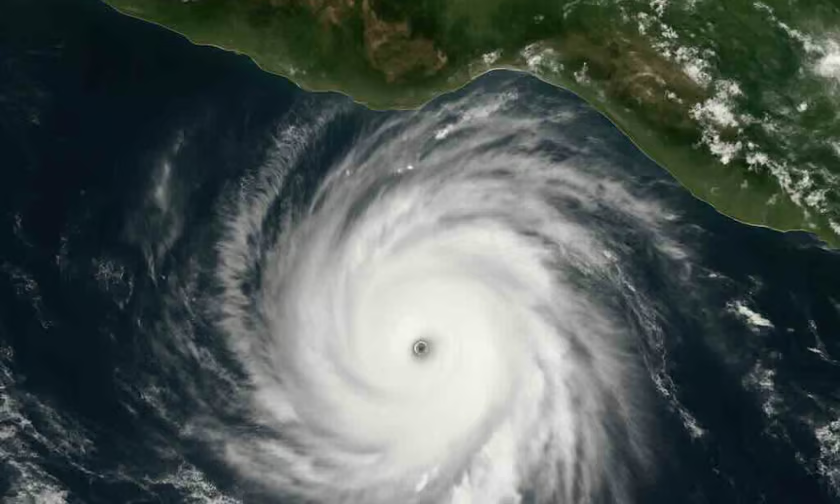
A slight wiggle in the storm’s path will decide whether it packages its full fury over empty rainforest or slams into the resort rooftops and shipping docks just down the road.
That uncertainty leaves the models themselves a moving target for underwriters.
Records for major early-season hits in the eastern Pacific are sparse, and rapid-intensity jolts in that basin have repeatedly outpaced pre-storm expectations-a pattern Atlantic watchers saw last summer.

In response, Mexico has kicked off emergency protocols, staging food, fuel, and gear while working in tandem with the national civil-protection network. Still, insurers warn that business-continuity plans and on-the-ground claims teams are already stretched thin after last years bruising record season.